| RIVER/STREAM: | WAH UMLIEM |
| GPS: | N25.28253 E91.74139 |
| ALTITUDE: | 647 m |
| NOTES: | A root bridge existed at this location until approximately 15 years ago, when it was destroyed in a landslide. |
A database for tribal botanical architecture

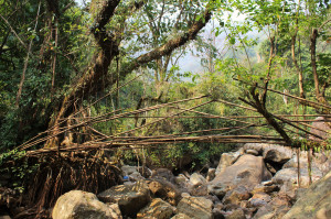
| RIVER/STREAM: | WAH UMLIEM |
| GPS: | N25.28253 E91.74139 |
| ALTITUDE: | 647 m |
| NOTES: | A root bridge existed at this location until approximately 15 years ago, when it was destroyed in a landslide. |
