
| RIVER/STREAM: | UNKNOWN |
| GPS: | N25.24512 E91.66030 |
| ALTITUDE: | 425 m |
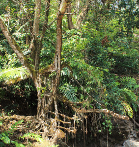
| NOTES: | This root bridge is said to have fallen about 15 years ago in a flood. A replacement bridge was constructed in 2014. The remnants of the bridge show signs of continued latex extraction damage. |
NOTE: PLEASE GO TO ANALYTICS AND ANALYSIS (APRIL 2017 DRAFT) FOR METHODOLOGIES. LR PROJECT DESIGNATION DOES NOT REFLECT LOCAL NAME.

