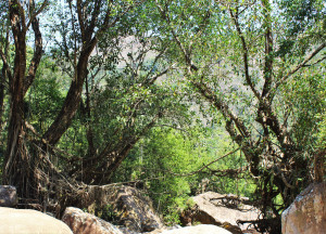
MAWLAM 4

IMG_2015
Remnants and newly connected roots on Mawlam 4.
RIVER/STREAM: WAH MYNSAW
GPS: N25.26363 E91.84269
ALTITUDE: 447 m
NOTES: A root bridge existed in this location, fell, and is now being reconnected. Roots from two ficus elastica trees are being wound together, and they now re-cross the span of the fallen bridge. No scaffolding is being used.
NOTE: PLEASE GO TO ANALYTICS AND ANALYSIS (APRIL 2017 DRAFT) FOR METHODOLOGIES. LR PROJECT DESIGNATION DOES NOT REFLECT LOCAL NAME.

Leave a Reply

Fill in your details below or click an icon to log in:

WordPress.com Logo

You are commenting using your WordPress.com account. Log Out /  Change )

Google photo

You are commenting using your Google account. Log Out /  Change )

Twitter picture

You are commenting using your Twitter account. Log Out /  Change )

Facebook photo

You are commenting using your Facebook account. Log Out /  Change )

Connecting to %s