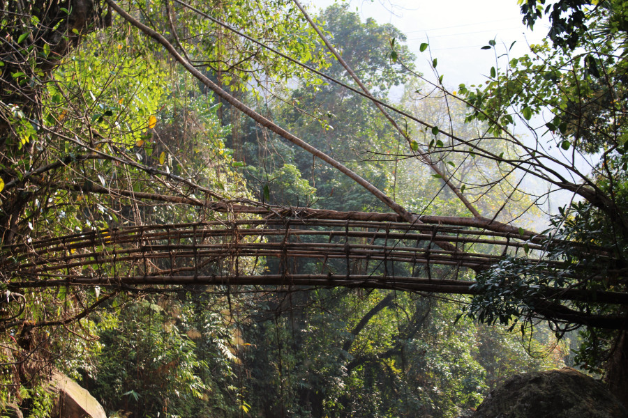
LAITIAM 4

IMG_1432

RIVER/STREAM: UMROHPEI
GPS: N25.22976 E91.75060
ALTITUDE: 409 m
NOTES: A root bridge existed in this location until about 5 years ago. It was destroyed in a fire. The tree is still alive, and several roots and branches have been trained along the bamboo replacement structure.
NOTE: PLEASE GO TO ANALYTICS AND ANALYSIS (APRIL 2017 DRAFT) FOR METHODOLOGIES. LR PROJECT DESIGNATION DOES NOT REFLECT LOCAL NAME.

Leave a Reply

Fill in your details below or click an icon to log in:

WordPress.com Logo

You are commenting using your WordPress.com account. Log Out /  Change )

Google photo

You are commenting using your Google account. Log Out /  Change )

Twitter picture

You are commenting using your Twitter account. Log Out /  Change )

Facebook photo

You are commenting using your Facebook account. Log Out /  Change )

Connecting to %s