RYMMAI 1

IMG_1553

RIVER/STREAM: WAH UMLWAI
LENGTH: 18.5 m
WIDTH AT CP: .7 m
HEIGHT AT CP: 3.5 m
GPS: N25.29749 E91.77993
ALTITUDE: 483 m
SR: 1
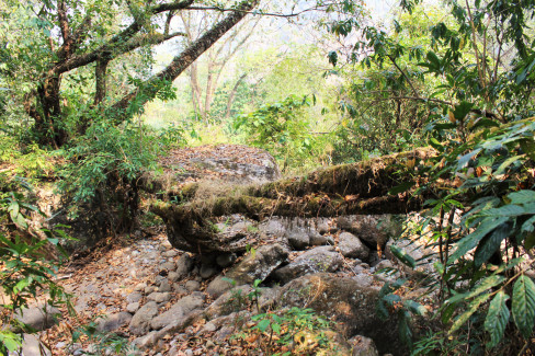
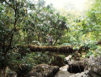
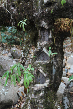
NOTES: A fragment of a much larger structure that has partially disappeared which crosses a branch of Wah Umlwai to a river island. The structure once continued from the river island to the opposite bank, but the other portion has fallen. The other portion would have been around twice as long as the remaining section. The remnant primarily consists of two very thick roots, indicating an old structure. The roots are still used occasionally as a bridge. Both are in poor condition, one having partially collapsed. Steps have been created in the side of the bridge by gouging footholds out of the sides of several secondary roots.
NOTE: PLEASE GO TO ANALYTICS AND ANALYSIS (APRIL 2017 DRAFT) FOR METHODOLOGIES. LR PROJECT DESIGNATION DOES NOT REFLECT LOCAL NAME.

Leave a Reply

Fill in your details below or click an icon to log in:

WordPress.com Logo

You are commenting using your WordPress.com account. Log Out /  Change )

Google photo

You are commenting using your Google account. Log Out /  Change )

Twitter picture

You are commenting using your Twitter account. Log Out /  Change )

Facebook photo

You are commenting using your Facebook account. Log Out /  Change )

Connecting to %s