| NOTES: |
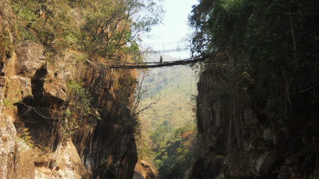
Exact measurements were not taken as crossing bridge was judged to be an unacceptable risk. The height of the bridge is clearly far above average. It’s a very recent structure. The thickest roots are only one or two inches in diameter. Abandoned. The trail that it serviced was bypassed by a road around 1996, meaning that the bridge only receives very limited local usage. A replacement steel wire bridge, which can be seen over the root bridge in the picture above, has also fallen into disrepair. Local interest in maintaining the structure appears to be limited. Spectacular, but a safety hazard. Much of the nearby jungle was cleared very recently. At the time of visit, shifting cultivation fires were burning within a few meters. |