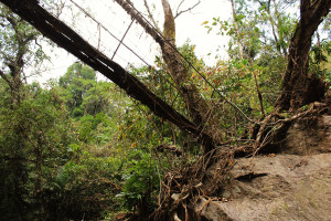
| RIVER/STREAM: | RYNSEIT |
| GPS: | N25.27709 E91.63076 |
| ALTITUDE: | 367 m |
| NOTES: | Here, a root bridge that is said to have failed around 20 years ago due to increasing numbers of rocks being brought down in floods on the Rynseit. A few roots are being grown along the replacement conventional structure. That structure, however, is also said to be in danger of being washed out. |
