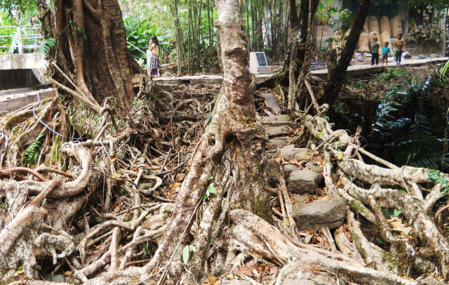
| RIVER/STREAM: | WAH RBAIN |
| LENGTH: NORTH/SOUTH (see notes) | 8.8 m/9.1 m |
| WIDTH AT CP: NORTH/SOUTH | 1.9 m/1.3 m |
| HEIGHT AT CP: NORTH/SOUTH | 5.7 m/5.7m |
| GPS: | N25.22155 E91.98137 |
| ALTITUDE: | 582 m |
| SR: | 9 |
| NOTES: | A root bridge with two parallel spans located in the middle of Burma village. The bridge is in exceptional condition. The local village council has outlawed latex extraction cutting. No damage was visible. A concrete bridge was recently built next to the root bridge, meaning that the root bridge is now redundant. According to local villagers, this was done because there was some concern that the root bridge would fail. The older span (to the right of the picture above) is said to be over 70 years old. The other span was planted by Blosson Majaw roughly 40 years ago. No scaffolding was used. Roots were simply pulled across the 9-meter gap of the Rbain river. |
