
| RIVER/STREAM: | WAH UMSONG (unconfirmed) |
| LENGTH: | 20.4 m |
| WIDTH AT CP: | 1.5 m |
| HEIGHT AT CP: | 11.3 m |
| GPS: | N25.30624 E91.80693 |
| ALTITUDE: | 774 m |
| SR: | 6 |
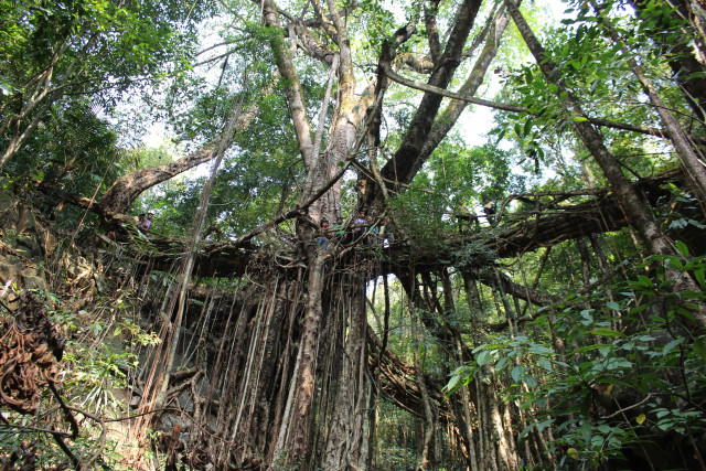
| NOTES: | A living root bridge formed from very large, old, tree. It is a twin span structure, though one span is no longer being used. Measurements were only taken on the span currently in service. The bridge is structurally stable, the roots being well established, however both the tree and the bridge are very badly scarred by numerous latex extraction cuts, many of them recent. It is next to an old village site. Due to soil depletion, the old village was divided up into several different villages occupying various sites nearby, but left the root bridge behind, providing further proof that the bridge is very old. |
NOTE: PLEASE GO TO ANALYTICS AND ANALYSIS (APRIL 2017 DRAFT) FOR METHODOLOGIES. LR PROJECT DESIGNATION DOES NOT REFLECT LOCAL NAME.

Thangkyrta 2 span.

Thangkyrta 2.

Part of the tree Thangkryta 2 is formed from, showing heavy latex extraction damage.

Thangkyrta 2 span.


Older span, Thangkyrta 2.

Looking up from underneath Thangkyrta 2.

The older span of Thangkyrta 2.

Thangkyrta 2.

Thangkyrta 2.

Thangkyrta 2.

Thangkyrta 2.
