
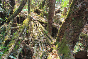
| RIVER/STREAM: | WAH ULKHIT |
| LENGTH: | 14.9 m |
| WIDTH AT CP: | .9 m |
| HEIGHT AT CP: | 3.9 m |
| GPS: | N25.29853 E91.80371 |
| ALTITUDE: | 800 m |
| SR: | 4 |
| NOTES: | An unusual root bridge with two merging spans. One seems to be older than the other. Measurements have been taken only of the longer span. The bridge is in use, and a few younger roots have been trained recently, showing that there is a certain amount of interest in maintenance. However, there is also very severe latex extraction damage across most of the structure. |
